The project will take several years to be achieved. Visitors to the museum can follow its progress by consulting the maps displayed in the room on the first floor of the mansion, maps which will be regularly added to.
Initially available in digital format, the Atlas will ultimately be produced in a paper version.
The objective is to gather together all the scientific elements around the topic, to transcribe the related data and to use maps to represent the way in which the estate and slavery, so closely linked, contributed to shaping the territory of Reunion, through its landscapes, its buildings and social organisation.
Slaves, defined in the Code Noir (the legal document regulating slavery) as ‘mobile goods’, were a social group subjected to a political and economic system that deprived them of any form of freedom and forced them to carry out economic functions with no compensation other than housing and food.
On Bourbon / Reunion, during the period when the island was a colony, slavery was both the determining factor and the consequence of the development of the society and the plantation economy which gave rise to the large estates.
Referred to in the Caribbean as the ‘plantation’, in the former Spanish colonies as the ‘hacienda’ or in Brazil as the ‘fazenda’, on Bourbon/Reunion island, the ‘habitation’ or estate was a rural agricultural or agro-industrial production structure of the colonial society.
On Bourbon / Reunion, different types of the estate were developed, notably:
-Food-crop estates (production of food crops)
-Coffee-growing estates (speculative coffee production)
-Sugar-cane estates (growing of sugar-cane)
-Sugar-producing estates (growing of sugar-cane and sugar production)
To be able to function, these estates needed a workforce which, until 1848, essentially consisted of slaves.
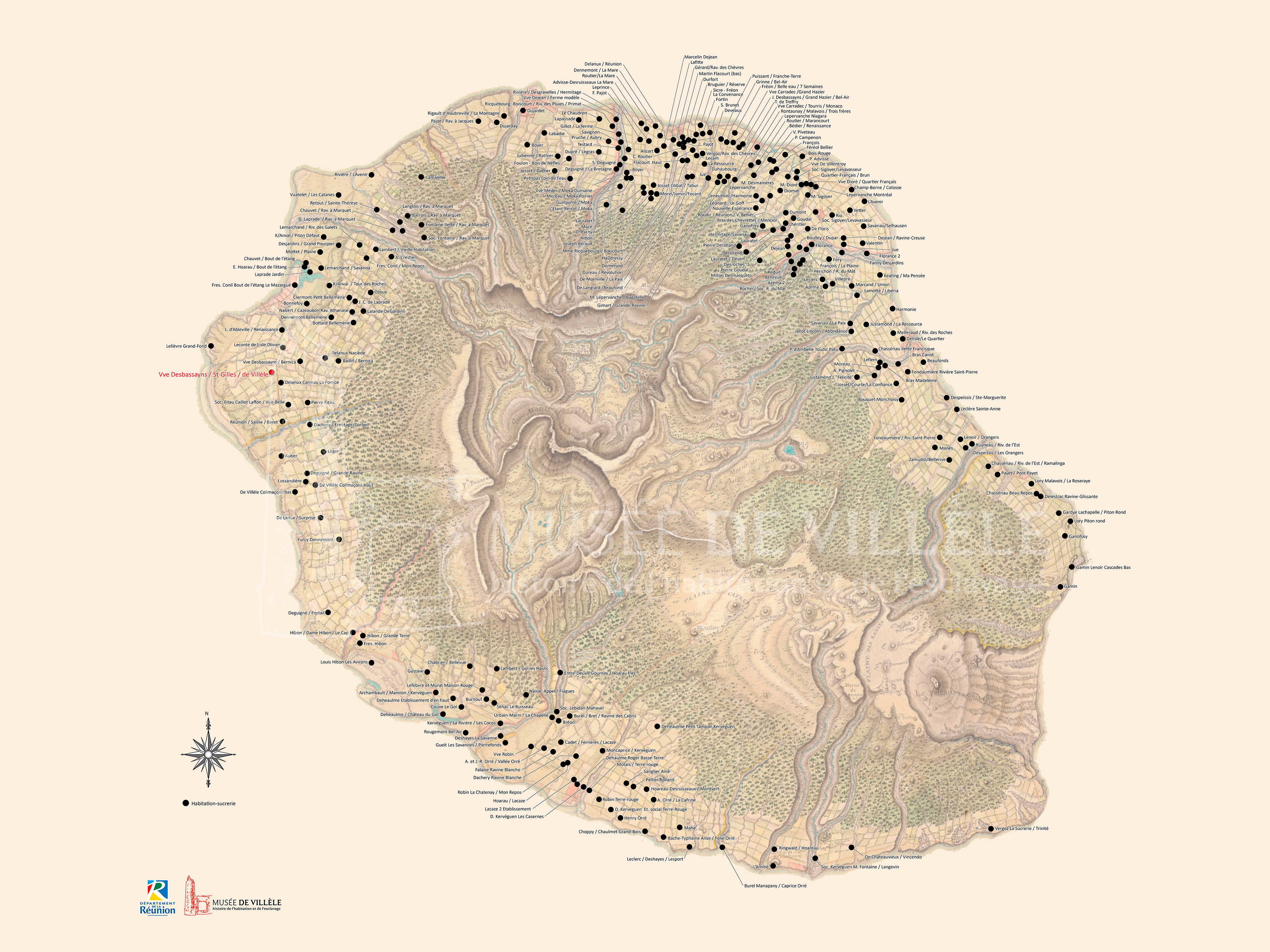
The map below shows all the sugar-producing estates existing on the island between 1785 and 1848. In fact, it was on the last type of estate that the majority of the slaves were to be found.
Domaine Panon-Desbassyns
Saint-Gilles-Les-Hauts
Tel. : 0262 55 64 10
Email: musee.villele@cg974.fr
Get there
Open from Tuesdays to Sundays 9.30am to 12.30pm and 1.30pm to 5.30pm
Closed on Mondays
Closed 1st May / 1st January / 25th December
Scientific committee
Legal notice